

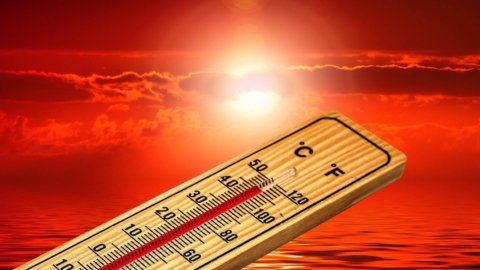
Italy faces the last day dominated almost entirely by extreme heatOn Monday 20 July the African anticyclone will continue to tighten especially in the Centre-South and the two major islands, with temperatures still above 40 degrees and 17 cities marked with a red dot from the Ministry of Health. In the North, however, the atmosphere will already begin to change, anticipating the turnaround expected in the coming hours.
From Tuesday 21 July the arrival of cooler air currents from Northern Europe should in fact break the long period of heat that has affected the country for about a month. the temperature drop will spread The weather will gradually move from the northern regions toward central and southern Italy, bringing highs closer to seasonal averages. Before the break, however, the clash between cool air and the very warm air accumulating in the lower layers could fuel intense thunderstorms, hailstorms, and violent gusts of wind.
Monday, July 20, the heat reaches its peak in the South
The new week opens with aItaly still divided in twoIn the North, skies will often be cloudy, especially in the central-eastern regions, with thunderstorms possible in Lombardy, the Veneto plains, and Emilia-Romagna. These storms may be locally intense, while more frequent showers will affect the central-eastern Alps and the Emilia-Romagna Apennines.
In the center, the weather will remain more stable over the Tyrrhenian regions and Sardinia. Increased cloud cover is expected along the Adriatic coast and the Apennine areas, with possible thunderstorms in the Marche region and isolated showers in Abruzzo. Sunny and warm weather will prevail in the south and Sicily, except for some cloud cover in Molise, Puglia, and Basilicata.
Temperatures will drop slightly in the northern regions, but will remain very high across the rest of the country. Highs are expected to hover around 36-37 degrees Celsius in Umbria, Lazio, and Abruzzo, rising to 41-42 degrees Celsius in Puglia, Basilicata, and Calabria. Sardinia and Sicily could reach 43 degrees Celsius, with even higher temperatures due to humidity.
Will 17 cities with the highest level of alert for heat wavesBari, Campobasso, Catania, Civitavecchia, Florence, Frosinone, Genoa, Latina, Messina, Naples, Palermo, Perugia, Pescara, Reggio Calabria, Rieti, Rome, and Viterbo. Milan, Turin, and several northern cities will return to the green zone, signaling the first easing of the emergency.
The turning point from Tuesday, fresh air from Scandinavia
Il The change of scenery will begin between the night and the day of Tuesday, July 21stA large low-pressure area over Scandinavia will favor the descent of cooler air currents toward central Europe and the Mediterranean, forcing the African anticyclone to gradually retreat southward and westward. The low-pressure front will initially cross the northern regions, then reach Tuscany, Marche, and inland central Italy. Temperatures will drop gradually, but could reach at least 5-6 degrees Celsius and, in places, approach 10 degrees Celsius compared to the peaks of recent days. Highs should thus generally return to between 30 and 33 degrees Celsius, still summery but much more bearable.
On Tuesday, the heat will remain intense in the south and on the major islands, where the decrease will be slower. Between Wednesday and Thursday, however, cool air will also reach the southern regions, easing the heat, especially along the Adriatic coast and inland.
Hail and downburst, the price of a truce
The end of the heat wave will not come without consequencesThe cooler, heavier air arriving from the north will slide beneath the warm, humid air that has been present over the peninsula for weeks, rapidly lifting it and favoring the formation of highly developed thunderclouds.
The thermal contrast and the large amount of energy accumulated in the atmosphere could generate storms, hailstorms, even large ones, and downbursts, sudden downward gusts capable of causing damage. The most exposed areas will initially be Trentino-Alto Adige, Veneto, Friuli-Venezia Giulia, Lombardy, and Emilia-Romagna.
From Tuesday instability will move Also toward inland Tuscany, Umbria, Marche, Abruzzo, Molise, and upper Puglia. On Wednesday, showers and thunderstorms could mainly affect Abruzzo, Molise, and Gargano, while on Thursday the unstable phase is expected to affect central and southern Italy more widely.
More normal temperatures at least until the end of July
After the passage of the front, the expansion of the Azores anticyclone should to promote a new improvement in the weather, but without immediately repeating the exceptional heat of recent weeks. A more stable situation is expected on Friday, July 24th, with the last thunderstorms concentrated in the lower Adriatic regions and gradually dissipating by the evening.
Between July 20th and 27th, Italy is expected to enter a more dynamic phase, with temperatures significantly lower than the extreme values reached so far and some thunderstorms linked to the disturbances passing over central Europe.
In 'high pressure could strengthen again in the last week of July and temperatures will rise slightly above average. At the moment, however, a new, long and intense heat wave like the one about to end is not in sight. After Monday's latest peak, the most anticipated turn of the summer should finally bring conditions closer to normal.