
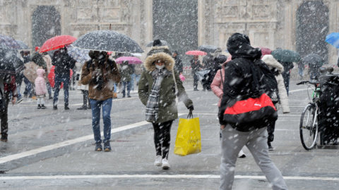
Un weekend anything but spring-like awaits Italy. After a period already marked by instability e temperature below average, the weekend weather is still confirmed to be cold and disturbed, with rains spread, winds strong and even INFO At unexpectedly low altitudes for the season. In some areas, flakes could reach altitudes as low as about 400 meters, particularly between Puglia and Campania. This is a decidedly unusual scenario for late March, which will create almost wintry landscapes, especially in the Apennines, between central and southern Italy.
One more detail to keep in mind: between Saturday and Sunday the time change is also back. During the night between Saturday and Sunday the clocks will have to be moved forward by one hour to the entrance into the hour legalA transition that gives us longer days, but also involves a little loss of sleep.
Weekend weather in Italy: unstable Saturday, a brief respite on Sunday
In the day of Saturday March 28 The situation remains rather unstable. The central Adriatic regions and much of the South will be the most exposed to severe weather, with rain, wind, and harsh weather. Cold currents will continue to influence Italy, keeping temperatures decidedly low: highs will struggle to exceed 12-13 degrees Celsius even in central and southern Italy. Winds will blow strongly in many areas, making the cold even more pronounced and contributing to rough seas and possible storm surges along the most exposed coasts. In the North, however, the weather will be more stable: mostly sunny, but with one factor not to be underestimated: nighttime frosts, especially in the northwest.
The day of Sunday 29 March The weather will see a slight improvement, although it will remain changeable. In the North, it will be cloudier, but generally without precipitation. In the Center, it will be variable, with temperatures still cool, especially in the mornings. In the South, it will be cold, but with some clearings and more frequent alternations between sun and clouds. A respite, then, but still far from true stability: the weather will remain below seasonal averages.
Weather forecast for next week: more bad weather. When will the heat arrive?
The weather forecast does not promise lasting improvements. Monday and Wednesday one is expected new disturbed phase, linked to the possible formation of a cyclone over the Mediterranean. This situation could bring rain and thunderstorms, especially in the South and, to some extent, in Central Italy, with a further drop in temperatures and almost winter-like conditions. The North, however, could be slightly more protected, with more stable conditions than the rest of the country.
Despite a still uncertain picture, some positive glimmer of hope could arrive in sight of the Easter holidaysLonger-term projections, yet to be confirmed, indicate a possible return of high pressure and a gradual improvement in weather conditions.
A change that, if confirmed, could finally mark the arrival of a more stable and milder phase, with a farewell to this long, cold and unstable period.