
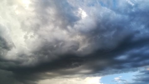
After weeks spent under the blanket of the African anticyclone, Italy is preparing for a change of scenery. From Wednesday, the extreme heat will slowly begin to loosen its grip thanks to the arrival of cooler currents from Northern Europe. truce awaited by millions of Italians which, however, will have a downside: the sharp contrast between the incoming fresh air and the heat accumulated in recent weeks will favor the formation of intense thunderstorms, hail e strong gusts of wind.
The change will not affect the country uniformly. For several days, Italy will remain divided: while the Center-North will have to contend with a period of marked instability, the heat will continue to be felt in the South and on the islands, with persistent mugginess and still-high temperatures.
Weather, the heat gives way to thunderstorms
The long heat wave is gradually coming to an end, especially in the North and along the Adriatic coast, where the temperature will return to values closer to the seasonal averages and, in some areas, even slightly lower. The temperatures, however, will be more moderate heat drop on Tyrrhenian regions Sardinia, where the heat will continue to be felt for a few more days.
The contrast between the scorching air and the cooler air will make the atmosphere particularly unstable. After the heavy rain and hailstorms that have hit several areas of the North in recent days, causing damage to cars, roofs, and photovoltaic systems, the bad weather will tend to gradually move towards the central regions and, between Thursday and Friday, also towards the Noon.
Weather and heat alerts: the areas most at risk
La instability phase will initially mainly concern the Center-North, where storm warnings and hydrogeological warnings remain in effect. Rainfall could be sudden and heavy, accompanied by hailstorms, gusts of wind, and possible flooding, with rapid rises in minor rivers.
At the same time the South will continue to deal with the heatwave. In the inland areas of Sicily and Sardinia, it will still be possible exceed 38-40 degrees, while the Ministry of Health maintains the red dot in various Italian cities: Bari, Cagliari, Campobasso, Catania, Civitavecchia, Florence, Frosinone, Genoa, Latina, Messina, Naples, Palermo, Perugia, Pescara, Reggio Calabria, Rieti, Rome e ViterboIn these centers, the combination of high temperatures and humidity poses a risk not only for the most vulnerable, but for the entire population.
Weather forecast until Friday
Wednesday July 22thIn the North, the weather will tend to improve after the storms of the previous days. Some showers will persist along the Apennine ridge, between Abruzzo, Molise, and Gargano, while in the lower Tyrrhenian Sea and the major islands, the heat will remain intense, with peaks of up to 39-40 degrees in inland Sicily.
Thursday July 23thUnstable conditions will extend to central and southern Italy, with showers and thunderstorms, especially in the second half of the day. Temperatures will also begin to drop in the southern regions, with a more pronounced drop along the Adriatic coast than along the Tyrrhenian coast.
Friday July 24thThe weather will gradually become more stable, with the last thunderstorms concentrated in the lower Adriatic regions and expected to ease by the evening. Temperatures will now be close to seasonal averages across much of the peninsula, with locally below-average temperatures in the northeast and along the Adriatic, while they will remain slightly higher in the Tyrrhenian regions and the major islands.
How long will the heat break last?
The break from the African heat may not be definitive, however. Initial trends indicate a possible new increase in temperatures Between the end of the weekend and the beginning of next week, especially in the South and along the Ionian coast, where temperatures could return to 36-38 degrees Celsius. For now, however, the final days of July should offer much more bearable weather than what characterized much of the month.