
Let's clarify this straight away, to avoid any misunderstandings since this is yet another formula in English and in this case not at all familiar: what is the Digital TwinA digital twin is a virtual replica of a physical object, system, or process that is constantly updated with real-time data from its real-world counterpart. This digital representation allows you to monitor, analyze, and predict the behavior of the physical system without having to intervene directly. In other words, a digital twin is a kind of digital mirror.
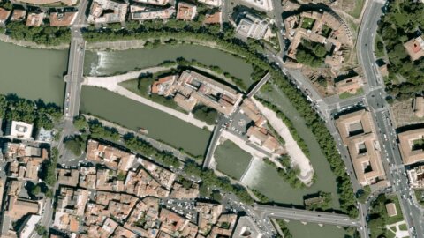
And there is a large Italian group, specialized in technology and solutions for the digital transition, which is investing heavily in it: Leonardo, through e-Geos, a company controlled by the Italian Space Agency (20%) and Telespazio (80%), has announced that it will support the Department of Sustainable Development (Diss) of the Ministry of the Environment and Energy Security (Mase) in the implementation of the digital twin of Italian soil, as part of the PNRR. This will involve developing a high-resolution digital terrain model that, using aerial laser surveys (LiDAR) and aerogravimetric data, will constitute a strategic element for understanding the morphology of the territory and the basis for future digital twins that will be able to simulate and further study its behavior.
Leonardo and the Diss project
The Diss project therefore has the objective of deepening the morphological knowledge of the Italian territory and of the gravity field at a national level, based on cutting-edge geoinformation solutions and on the consolidated experience of the Leonardo group, a point of reference in the sector for expertise and innovative capacity. In this regard, the reproduction of a model of the entire national territory represents a foundation for a safer and more sustainable Italy Thanks to an unprecedented level of precision in understanding the land and subsoil. Consider, for example, seismography and earthquake prevention, but also hydraulic modeling, necessary for the delimitation of potentially flood-prone areas, and the possible discovery of new geological features.craw materials. The mapping will be carried out using aerial surveys, with laser technologies (Laser Scanning LiDar Light Detection and Ranging).
This ambitious project marks a turning point in the integration of digital and geospatial technologies, once again demonstrating the Leonardo Group's commitment. "Our company," said Massimo Claudio Comparini, Managing Director of Leonardo's Space Division, thanks to its leadership in space, digital, and Earth observation technologies, is strongly committed to developing solutions for the creation of digital twins, integrating data collection, processing, and information extraction capabilities with supercomputing, cloud computing, and artificial intelligence. This strategic project, which combines innovation, vision, and collaboration between the public, private, and academic sectors, lays the foundation for in-depth and intelligent knowledge and management of the territory, supporting resilience and sustainability. Leonardo is committed to placing its expertise at the service of the country and Europe.
“With this project – he added Milena Lerario, CEO of e-Geos -, the company,
supported by Leonardo's vision, it offers its experience in managing large
volumes of geospatial data to provide a concrete tool to support environmental policies and
territorial areas of the country. The digital twin of the soil will offer a dynamic and precise representation of the
Italian territory, useful for studying risks and optimizing interventions. It's a technological and operational challenge.
which we face with great responsibility, alongside our partners, to contribute to a more
sustainable and conscious.”